
Services
-

Environmental Planning
GSD are well versed in satellite imagery analyses that support the sector including land cover classification to quantify impact, and develop mitigation and regeneration plans. GSD sounds, process and use high and very high-resolution satellite imagery in conjunction with a range of geospatial tools and GIS to assist our clients. Experience includes site appraisal and suitability analyses and the geospatial requirements of Environmental Impact Analysis.
-

Forestry
GSD provides in-house GIS expertise to forestry organisations in Wales, UK. Our work includes spatial data management of large asset databases, editing and analysis and visualisation. We work closely with field surveyors who specialise in forestry, woodland management and mensuration techniques and provide mobile mapping and data collection support. GSD are also well versed in Forestry Resource Planning and Stakeholder engagement to assist clients.
-
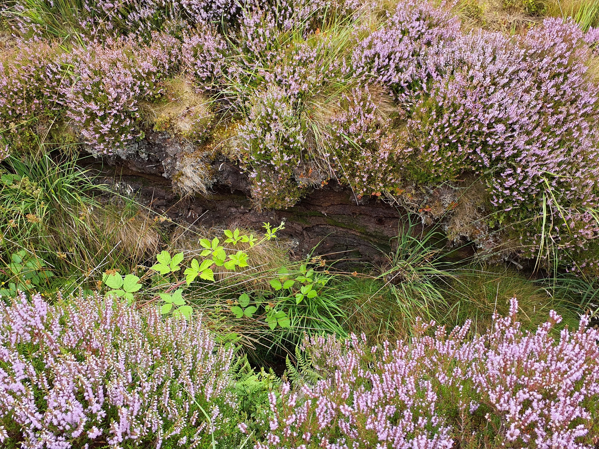
Peatlands
GSD works closely with experienced field surveyors, trained in forestry, woodland management and peat surveying, to provide comprehensive surveys of both afforested and non-afforested peat. Our surveys include depth and core sampling, vegetation surveys and yield class assessment of trees present. To facilitate data collection GSD use mobile GIS and cloud based data transfer, to allow for detailed and streamlined surveying, GSD create high quality reports and bespoke data in consultation with clients
-

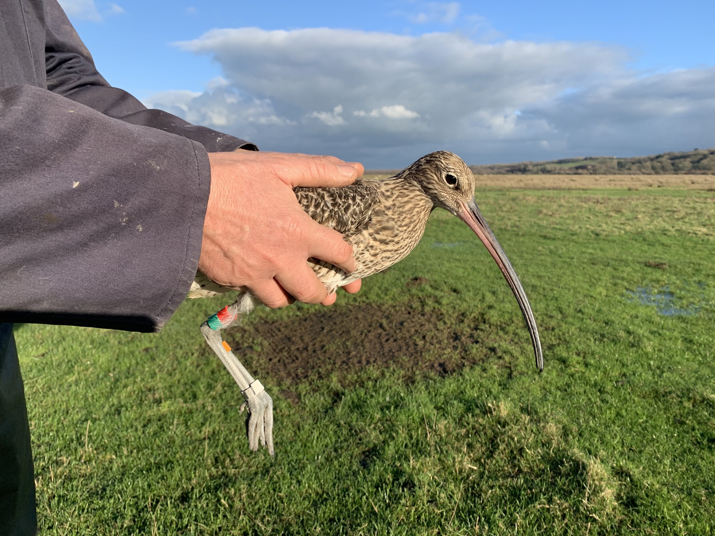
Land Management and Conservation
High resolution satellite Earth Observation imagery, coupled with extensive field data and knowledge provided by clients and Associates, enables GSD’s in house consultants to use advanced analytical techniques in data modelling to create reliable and robust species distribution models. GSD also supports land conservation surveyors, collecting and managing field data using mobile applications in the field to be utilised further using GIS.
-

Energy
GSD are experienced in Site Suitability Analysis for wind and solar developments. We offer constraints analysis around substation locations and use GIS to carry out Alternative Site Assessments. GSD create bespoke suitability models using a range of spatial parameters, scored and weighted in consultation with clients. GSD also offer online mapping platforms to clients to further interrogate and utilise the available spatial data.
-

Infrastructure and Transport
GSD use high resolution imagery combined with consultation from in-country field ecologists and surveyors to develop land cover and habitat models built using in-house scripting and professional remote sensing software. This provides data on the location of sensitive habitats and areas for regeneration for example, and informs the entire planning and development process.
-

Landscape and Heritage
GSD provides a range of GIS services to landscape and planning professionals using spatially referenced or geospatial data. GIS is an effective tool to assess the potential visual and landscape impacts of proposed developments. Our work in this field includes data management, mapping, online mapping tools and 3D visualisations.
-
Research and Education
At GSD we feel strongly about education and research and we participate in a number of large research projects working collaboratively with partners across the UK and Europe. We provide expert knowledge of Earth Observation, mobile mapping and data collection and the use of satellite EO to support our partners in a variety of ways.
-

Drones
Geo Smart Decisions are experienced drone operators who deploy multi-rotor aircraft to collect high resolution imagery, videos and 3D data to support clients with bespoke applications across the environmental sector. GSD can provide both aerial imagery and lidar data for use in 2D/3D modelling.