
Environmental Planning
Geo Smart Decisions has a great deal of experience using GIS as well as applying satellite imagery analyses to support the environmental planning sector.
Land cover classification using satellite imagery, particular over large and remote areas is critical to understand a quantify impact and develop mitigation and regeneration plans for example.
Geo Smart Decisions consultants can access, process and analyse high and very high-resolution satellite imagery to provide this kind of support. In addition, we use a range of geospatial tools, data and Geographical Information Systems (GIS) software to manage and utilise our client’s data and contribute to planning documents, site appraisal and suitability analyses as well as all spatial aspects of the Environmental Impact Analysis process. GSD support a number of disciplines and work with experts in noise, landscape, ecology and air quality.
-

Mapping Island Reefs
GSD was contracted to create satellite derived bathymetry models (SDB) and benthic habitat models for an island close to Tanzania using depth and habitat field survey data together with satellite Earth Observation (EO) imagery. Data used included freely available and atmospherically corrected Sentinel-2 (S2) imagery (10 m spatial resolution) and WorldView3 imagery from Maxar.
-

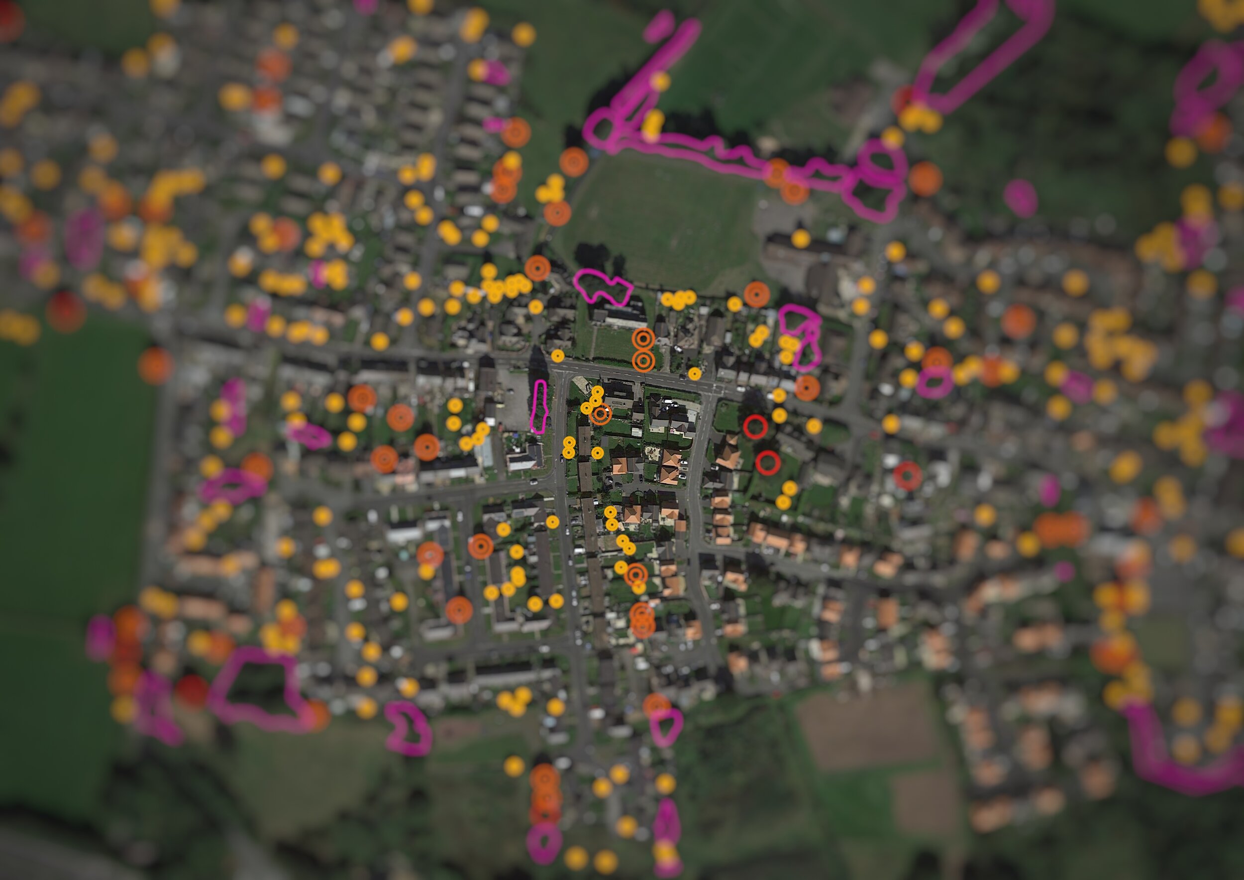
Quantifying Urban Tree Canopy using GIS
This Wales-wide project was assigned to GSD by Natural Resources Wales (NRW) and looked to update the data held on Wales’ Urban Tree Canopy Cover by comparing data with updated aerial imagery. From specifications set by the client, processes were created for a consistent approach to the analysis and quality assurance of the data created across a team of five analysts.
-

Island Habitat Mapping UAE
GSD sourced and pre-processed very high resolution spatial data (2 m x 2 m pixel sizes) imagery for this detailed habitat mapping project. After atmospherically correcting the imagery using python scripting and open source libraries, training data was generated in close consultation with the client and was used to generate habitat models, which were then discussed iteratively with the client.
-

Site Suitability Modelling of Seaweed Farms
GSD successfully provided contracted GIS services for Project Madoc, a feasibility study investigating the potential for sustainable cultivation of native species of seaweed in multiple identified locations in Wales, funded by the European Maritime and Fisheries Fund (EMFF).